This page will help you find living materials in the local area around Karlsruhe and learn more about local material knowledge. It's a growing series of maps that will be constantly refined over the period of the Living Library project.
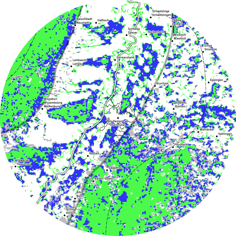
Map 0Karlsruhe Ecoregion
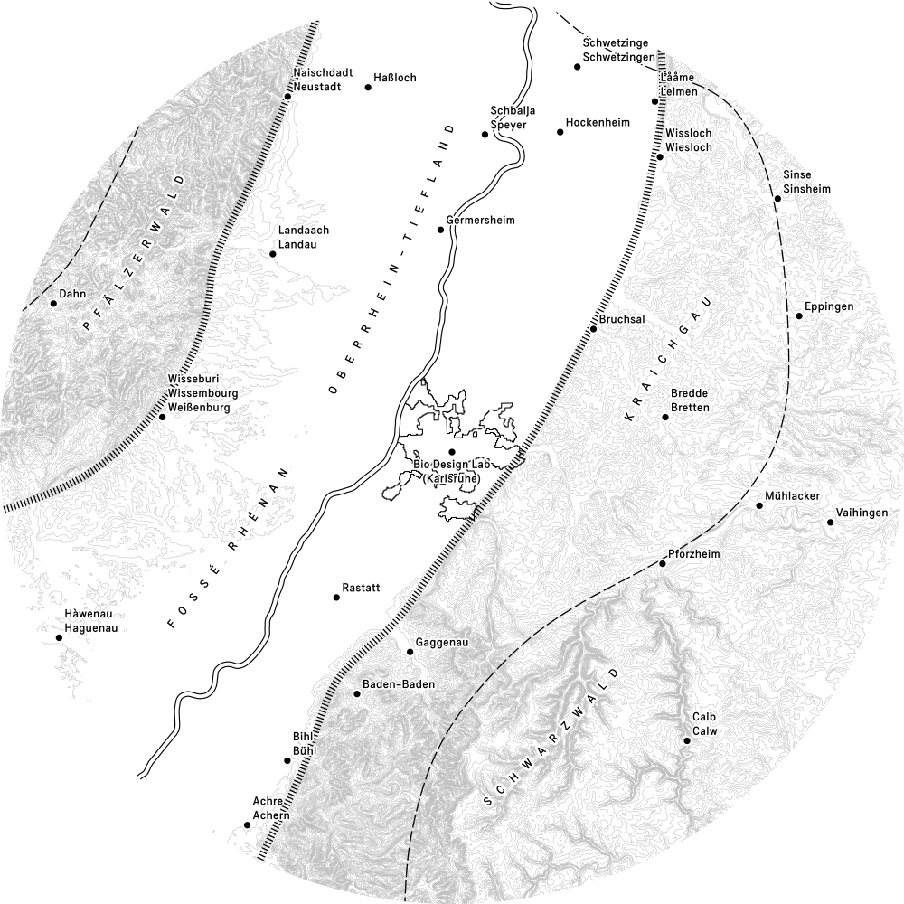
Grundkarte / Base map: OpenStreetMap contributors, Urban Morphological Zones (UMZ) 2006 / European Environment Agency (EEA), HfG Student•innen und Mitarbeiter•innen, Lisa Ertel & Anne-Sophie Oberkrome (Atelier LUMA), Geologie am Oberrhein / Staatliches Museum für Naturkunde Karlsruhe, European Digital Elevation Model 1.1 2016 (EU-DEM) / European Environment Agency (EEA), Corine Land Cover 2018 (CLC2018) / European Environment Agency (EEA), OpenDEM / Produced using Copernicus data and information funded by the European Union - EU-DEM layers.
To reflect the region’s cultural diversity, all cities on the map are written in both their local and national names.
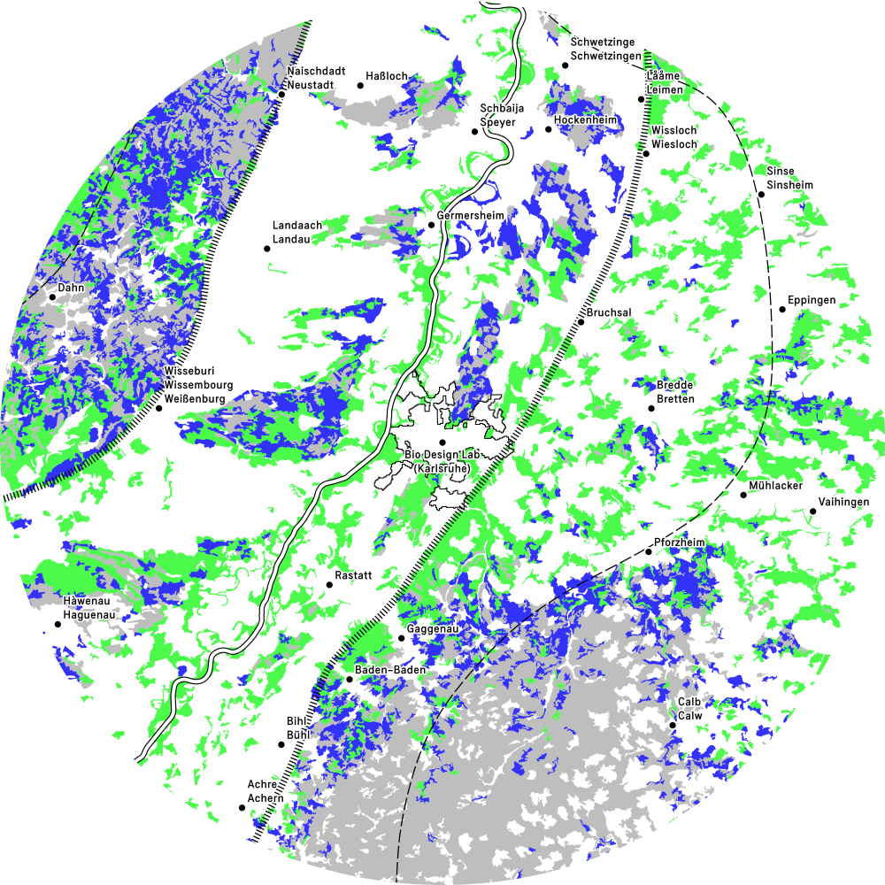
Map 1Compost sites and allotment gardens
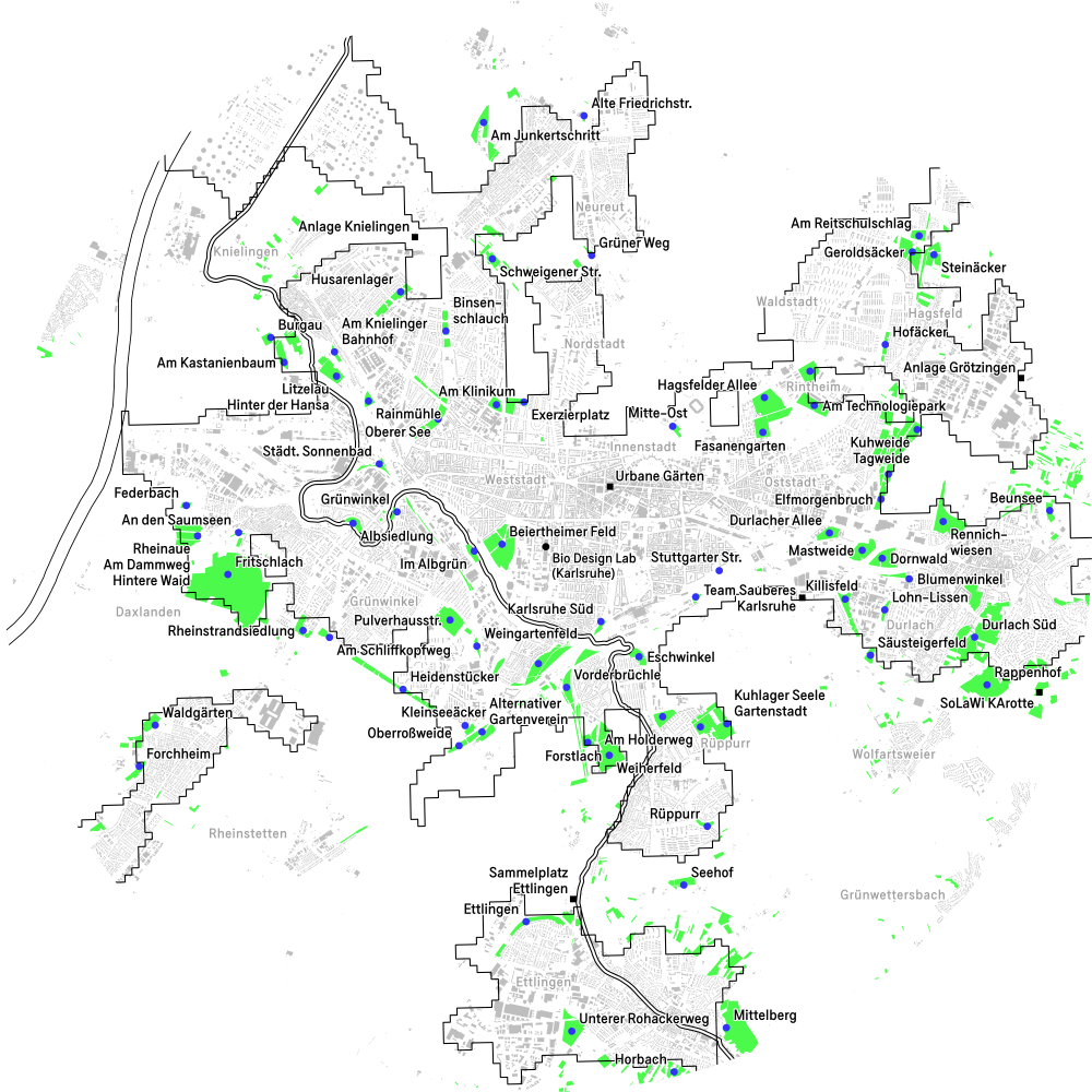
Grundkarte / Base map: OpenStreetMap contributors, Urban Morphological Zones (UMZ) 2006 / European Environment Agency (EEA), HfG Student•innen und Mitarbeiter•innen, European Digital Elevation Model 1.1 2016 (EU-DEM) / European Environment Agency (EEA), Corine Land Cover 2018 (CLC2018) / European Environment Agency (EEA). Bezirksverband der Gartenfreunde Karlsruhe, Bürgerservice Karlsruhe, Herr Reiner Dick / HumuStutensee.
Garden clubs hold knowledge about different ways of composting. To become a member of a garden club, please visit the website of the Bezirksverband der Gartenfreunde Karlsruhe.
Map 2Food waste
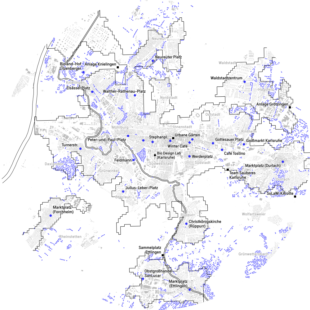
Grundkarte / Base map: OpenStreetMap contributors, Urban Morphological Zones (UMZ) 2006 / European Environment Agency (EEA), HfG Student•innen und Mitarbeiter•innen, Corine Land Cover 2018 (CLC2018) / European Environment Agency (EEA), Streuobsterhebung (Fernerkundung) / Daten aus dem Umweltinformationssystem (UIS) der LUBW Landesanstalt für Umwelt Baden-Württemberg, Karlsruher Naturkompass / Agenda 21 Karlsruhe.
For a guide on harvesting public fruit, nuts, and herbs, please search for the “Foraging Code of Conduct”, written by Urban Edibles.
Map 3Livestock
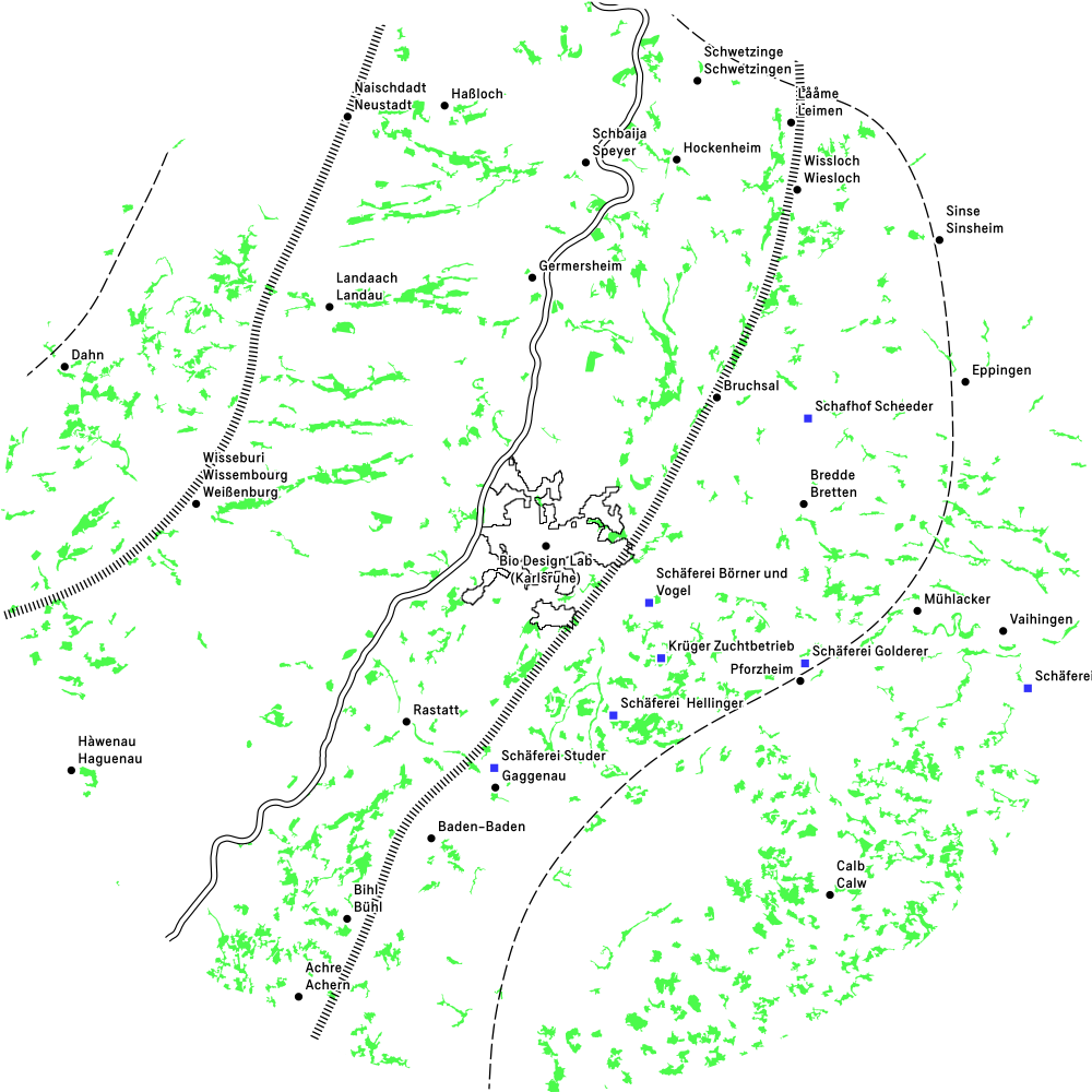
Grundkarte / Base map: OpenStreetMap contributors, Urban Morphological Zones (UMZ) 2006 / European Environment Agency (EEA), HfG Student•innen und Mitarbeiter•innen, European Digital Elevation Model 1.1 2016 (EU-DEM) / European Environment Agency (EEA), Corine Land Cover 2018 (CLC2018) / European Environment Agency (EEA).
Map 4Mushrooms
Grundkarte / Base map: OpenStreetMap contributors, Urban Morphological Zones (UMZ) 2006 / European Environment Agency (EEA), HfG Student•innen und Mitarbeiter•innen, European Digital Elevation Model 1.1 2016 (EU-DEM) / European Environment Agency (EEA), Corine Land Cover 2018 (CLC2018) / European Environment Agency (EEA), European Soil Database / European Soil Data Centre (ESDAC).
Soil rich in organic carbon (SOC) and with slightly acidic to neutral pH is often a good indicator of mushroom growth.
Map 5Trees
Grundkarte / Base map: OpenStreetMap contributors, Urban Morphological Zones (UMZ) 2006 / European Environment Agency (EEA), HfG Student•innen und Mitarbeiter•innen, Corine Land Cover 2018 (CLC2018) / European Environment Agency (EEA).
Map 6Invasive plants
Grundkarte / Base map: OpenStreetMap contributors, Urban Morphological Zones (UMZ) 2006 / European Environment Agency (EEA), HfG Student•innen und Mitarbeiter•innen, iNaturalist.org / iNaturalist contributors, Differing impacts of two major plant invaders on urban plant-dwelling spiders (Araneae) during flowering season (Bauer et al., 2021).